

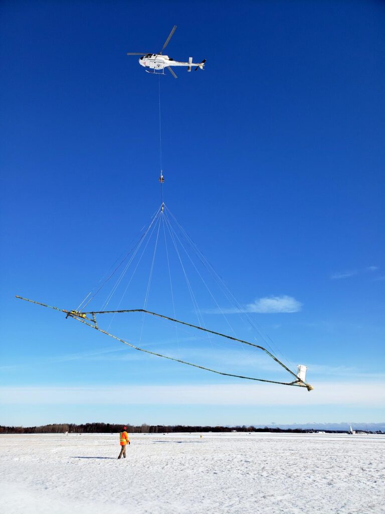
If you spot a hovering helicopter with an unusual contraption hanging below, don’t panic.
It’s part of a cooperative study between the Michigan Department of Environment, Great Lakes and Energy (EGLE) and the United States Geological Survey (USGS) to map underground aquifers and geology to better manage groundwater resources.
Cass County is one of the 16 counties in Southwest Michigan where the helicopter, towing a large, hexagonal “hoop” about 100 feet below the aircraft, can be seen. The helicopters, which will be flying about 200 feet above the ground, will only fly during the day and are operated by trained pilots. EGLE officials said the aircraft will not fly directly over densely populated areas or houses and pose no risk to people, pets or livestock.
The helicopter will fly roughly 200 feet above the ground as the system measures differences in the Earth’s electrical properties and magnetic fields examining bedrock depth, soil and rock composition, aquifer locations and structure, and how groundwater moves and connects to rivers and lakes.
The helicopters are in the air now and expected to be circling the skies until mid to late summer.
This story was compiled and written by Jodi Marneris with information from the EGLE and USGS websites.